கோயம்புத்தூர் முழுமை திட்டம் 2041

South India’s Manchester
The Place of Opportunity for Start-up Industries!
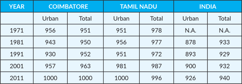
Coimbatore Ranked Second in the Sustainable Development Goal.
The vision of the Coimbatore’s second master plan is to develop Coimbatore Local Planning area as an economic region with locally competitive
infrastructure and social amenities. In short it aims for a sustainable inclusive sponge city development to establish a better standard of life by integrating the natural areas with a controlled development and achieve a comfortable micro climate
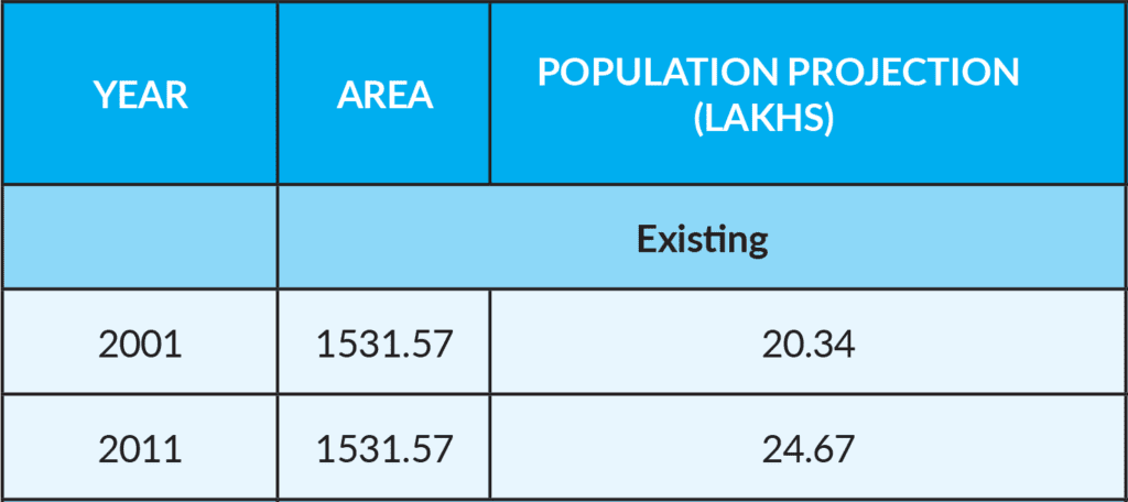
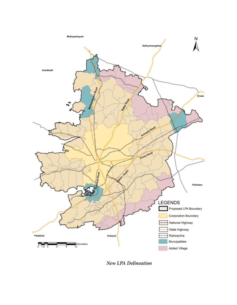
| S.No | Administrative Unit | No. of Local Bodies | No. of Villages | Area (Sq.km) |
|---|---|---|---|---|
| 1 | Corporation | 1 | 24 | 257.81 |
| 2 | Municipality | 4 | 4 | 97.56 |
| 3 | Town Panchyat | 21 | 24 | 314.93 |
| 4 | Village Panchayat | 66 | 66 | 861.27 |
| 92 | 118 | 1531.57 |
The Tamil Nadu Town and Country Planning Act, 1971, an Act to provide for planning the development and use of rural and urban land in the State of TamilNadu, states the Master Plan may provide for any or all of the following matters:
திட்டப்பகுதியில் நிலம் எந்த முறையில் பயன்படுத்தப்பட வேண்டும் என்பது;
குடியிருப்பு, வணிக, தொழில் மற்றும் வேளாண்மை நோக்கங்களுக்காகவும் பூங்காக்கள் விளையாட்டுத் திடல்கள் திறந்த வெளிகளுக்காக நிலத்தை ஒதுக்குதல்; அல்லது ஒதுக்கி வைத்தல்;
பொதுக் கட்டடங்கள், பொது நிறுவனங்கள், பொது வசதிகளுக்காக நிலத்தை ஒதுக்குதல் அல்லது ஒதுக்கி வைத்தல்;
தேசீய நெடுஞ்சாலைகள், முதன்மைச் சாலைகள், எல்லைப்புற வட்டவடிவச் சாலைகள் (Ring Roads) பெரிய தெருக்கள், இருப்புப்பாதைகள், விமானதளங்கள், கால்வாய்கள் உட்பட போக்குவரத்து ஏற்பாடுகளுக்கு வகை செய்தல்;
போக்குவரத்தும், சரக்குப் போக்குவரத்து முறையும் போக்குவரத்துச் சுற்றோட்ட முறையும்;
The major road and street improvements;
The areas reserved for future development, expansion and for new housing;
The provision for the improvement of areas of bad layout or obsolete development and slum areas and for relocation of population;
The amenities, services and utilities;
The provision for detailed development of specific areas for housing, shopping, industries and civic amenities and educational and cultural facilities;
The control of architectural features, elevation and frontage of buildings and structures;
The provision for regulating the zone, the location, height, number of storeys and size of buildings and other structures, the size of the yards and other open spaces and the use of buildings, structures and land;


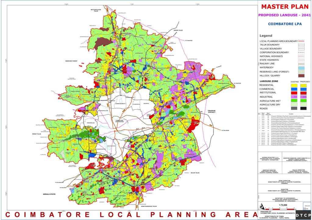

The growth of Coimbatore appears to be following the same trend of development as that of Tiruppur. The portion of Coimbatore that is expected to experience the most expansion is the eastern half of the city, specifically along the Avinashi Road and the Trichy road. Because of the natural barrier that is the Western Ghats, there are limitations placed on the area of Coimbatore that is designated for development.
The undevelopable zone may be found in the western portion of the Coimbatore Local Planning Area (LPA). Tiruppur, on the other hand, is expanding toward the western section of the city, which is in the direction of Coimbatore. These two cities are projected to expand in a direction that is toward one another. As a result, Coimbatore and Tiruppur are considered to be Master plan for Coimbatore LPA 2041253 – twin cities due to the similar patterns of economic development that they exhibit.
It has been determined that the rise of these two cities will serve as the economic centre that will be necessary for twin city development. The maps show the Existing Industrial growth centers Coimbatore LPA.
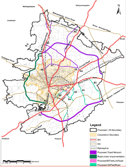
Integrating economic planning with the proposed transport network plan is a strategic approach to promote sustainable development , efficient resource allocation, and improved connectivity within a region or country. This integration involves coordinating economic goals, infrastructure development, and transportation systems to achieve better outcomes. The identified potential
economic growth centres are shown image.
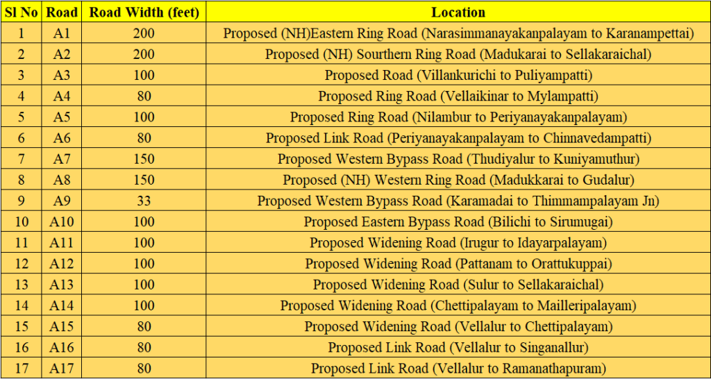
The proposed 200 feet link roads on the eastern part are connecting the proposed economic growth nodes. The proposed 100 feet and 80 feet roads are connecting the 200 feet link roads. These roads can provide direct access to industrial areas, freight terminals, multimodal logistic park and other economic generating centres, thereby facilitating the movement of goods to and from manufacturing and distribution centres.
By aligning the two critical aspects of development – economic growth nodes and the transportation corridor, regions and countries can create synergies that promote economic prosperity, improved quality of life, and environmental sustainability.

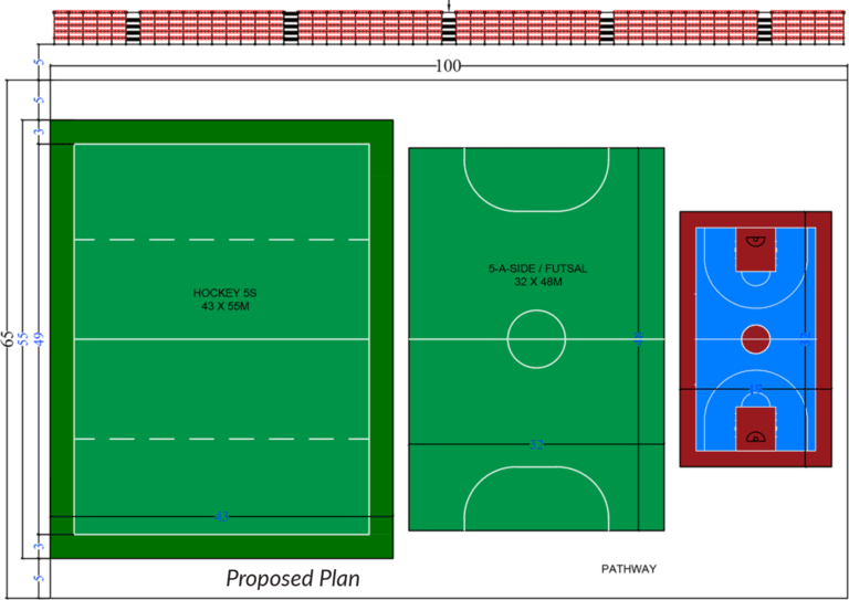
Multi use Sports complex is proposed in RS Puram, Sastri Maidan along with the Hockey Ground.

There are 26 Villages have been indentified for implementing the Grid of Roads. Proposed Junction Improvement